
Going Beyond: The Best Alternatives to Google Maps in 2024
Operating since 1998, Google is one of the world’s top corporations. Google’s legendary Internet search engine makes it possible to find information quickly, while the now free version of Google Maps leads you to your destination more efficiently than many in-car navigation systems that require a hefty surcharge. So it’s not surprising that many people think of Google Maps when hearing about a navigation app or maps. But is Google Maps the only option on the market? Can other noteworthy solutions also be found among geographic information systems? You can find out by reading the article.
What are geographic information systems?
Geographic Information Systems (GIS) are designed to work with data located in space referenced to the Earth. The data describe objects or phenomena occurring on the Earth’s surface, beneath its surface, or in its atmosphere. These data can be assigned coordinates defined in a reference system associated with the Earth’s solid. As a result, Geographic Information Systems enable the collection, storage, sharing, processing, analysis, and visualization of spatial data.
Geographic Information Systems use advanced technologies to integrate information about places, objects, phenomena, and events related to geographic space. With GIS, it is possible to mine location data to explore spatial relationships and detect patterns, enabling informed decision-making based on the analysis of geographic data.
In what areas do GIS systems find the application?
- a data processing system for visualization: e.g., for map production, for visualization in 3D;
- information system: e.g., in documentation, in services;
- management system: e.g., for real estate management, natural resources;
- planning system: e.g., in construction work, roads, in the supplying water, gas, and energy to the public in emergency operations;
- navigation system: for sea, air, and road transportation;
- data analysis system: e.g., in optimization issues, in solving environmental issues.
An essential feature of GIS is the ability to work with large and complex geographic data sets, including maps, satellite images, results of field measurements, as well Gs demographic and economic data. This makes it possible to understand the complex patterns and relationships found in geographic space and respond appropriately to the challenges and problems of our environment.

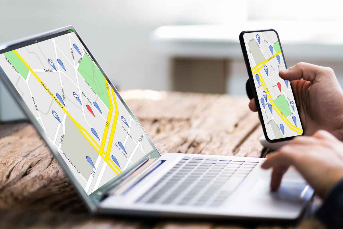
What are Geographic Information System (GIS) maps?
GIS maps utilize geographic data and spatial analysis, processed and examined through GIS software to present and explore information concerning the Earth’s surface. Unlike traditional paper maps, GIS maps possess dynamic and interactive features.
Various types of GIS maps exist, including category maps, heat maps, cluster maps, bubble maps, and quantity maps.
A crucial component of any GIS is the map layers. Each layer represents a distinct facet of the geographic data under analysis, and these data layers can be activated or deactivated to exhibit only the pertinent information for a specific study or map.

Popular GIS systems
All GIS systems have unique features and applications, and their popularity stems from a rich feature set, intuitive user interface, and support for a broad user community. Among the popular solutions are:
1. Esri ArcGIS
ArcGIS is one of the most popular and advanced GIS systems. It offers comprehensive tools for creating, managing, analyzing, and visualizing geospatial data. It has a wide range of modules, including ArcMap, ArcGIS Pro, and ArcGIS Online, which allow you to work across platforms and modes.
2. QGIS
QGIS is a free, open-source GIS that is easy to use and offers many features. It is popular because of its availability on multiple platforms, rich user community, and ability to expand functionality through plug-ins.

3. MapInfo Professional
MapInfo Professional is a commercial GIS system with high popularity. It provides advanced tools for creating, analyzing, and visualizing geospatial data. It is often used in urban planning, real estate management, and market analysis.
4. GRASS GIS
GRASS GIS is a free GIS system with strong support from scientists and researchers. It offers advanced tools for spatial analysis, terrain modeling, and hydrological analysis.
5. Google Earth Pro
Google Earth Pro is a popular GIS tool that allows exploring 3D satellite images, terrain models, and geographic data worldwide. It is used for both professional and recreational purposes.

Most important statistics on GIS in 2024
The Geographic Information System (GIS) market is experiencing significant growth and is expected to continue this trend in the coming years. Here are some key statistics and trends in the GIS market through 2023:
The Global GIS market is expected to grow significantly between 2023 and 2031. The market showed steady growth in 2022, and this trend is predicted to continue due to the adoption of strategies by key players. North America, particularly the United States, plays a crucial role in this market growth, with Europe also contributing significantly. GIS Market Research Report 2023 projects that the GIS market size will reach a substantial value in millions by 2029, growing at an impressive CAGR from 2022 to 2029. The market’s expansion is attributed to technological innovation, improved product performance, and increasing application in various sectors.
- 2022 Market Valuation: The GIS market was valued at approximately $11.43 billion in 2022.
- 2027 Forecast: The market is projected to reach $20.82 billion by 2027, continuing its CAGR of 12.6%.
- Market size in 2021: Another analysis estimated the market size at $8,914.4 million in 2021.
- 2030 Growth Forecast: This report forecasts growth to $25,121 million by 2030, at a CAGR of 12.2%.
- 2022-2032 Growth Forecast: The 2022 market size of $11.6 billion is expected to grow to $41.3 billion by 2032, at a CAGR of 13.7%.
These figures underscore the dynamic and expanding nature of the GIS market, reflecting its increasing relevance across various sectors.
Sources: P&S Intelligence, Acumen, GlobNewswire, GIS Market Research Report 2023.
Is Google Maps a GIS?
Yes, Google Maps can be considered a geographic information system (GIS), but it is a simplified version of a GIS. Google Maps offers many features typical of GIS systems, such as map display, navigation, place search, satellite images, etc.
However, Google Maps has limited spatial data analysis and management capabilities compared to advanced GIS systems such as ArcGIS, MapInfo Professional, or QGIS. It is more focused on providing simple tools for viewing and using maps.
Best Google Maps Alternatives
Now that traveling is part of our daily lives, navigation apps are indispensable. Whether you are looking for the best route to the theater, a hotel on vacation, or want to explore new places, there are many options to consider.
Navigation apps have gained tremendous importance in today’s smartphones, and among them, Google Maps is extremely popular. Nevertheless, there are many other navigation apps worth considering. Let’s see which ones stand out from the competition and are good Google Maps alternatives.
1. Waze: one of the Google Maps alternatives
One of the top alternatives to Google Maps is the Waze app, available for iOS and Android devices. What sets it apart from other navigation apps is its community of users, which constantly provides updates on traffic data, accidents, and other incidents on the road.
This allows you to avoid traffic jams and get to your destination faster. In addition, Waze offers features such as speed camera alerts and gas stations with the lowest prices, making it a handy app for drivers. Due to its considerable popularity, Waze was purchased by Google in 2013. However, it is still a standalone app, not part of Google Maps.

Advantages and disadvantages of the Waze app:
Advantages:
- User community,
- Traffic jam avoidance option,
- Speed camera notifications,
- Finding the cheapest gas stations,
- Personalization – preferred routes, notifications, and map colors.
Disadvantages:
- High battery consumption,
- Dependence on the internet connection,
- Lack of offline functions,
- Dependence on the user community.
2. Apple Maps: The Privacy-Friendly Alternative to Google Maps
Regarding privacy-conscious alternatives to the Google App, Apple Maps stands out as one of the top choices. Designed exclusively for iOS devices, Apple Maps has undergone significant improvements since its initial release.
As an iPhone owner, you’ll find it hard to replace this app when searching for places or navigating to your destination. Apple has gone above and beyond to ensure its native web mapping app and services prioritize privacy. Moreover, they have successfully addressed the accuracy issues and bugs in the app’s initial version.

Advantages and disadvantages of the Apple Maps:
Advantages:
- Seamless integration with the Apple ecosystem: Apple Maps is available on iPhones, iPads, and Macs, making it easy for users of these devices.
- The intuitive and clean user interface,
- Siri integration,
- Realistic 3D visualizations for selected cities and locations,
- Live updates.
Disadvantages:
- Fewer data and features than competing apps have,
- Less accurate data in some regions, which can lead to erroneous route guidance,
- Fewer features for users outside the Apple ecosystem,
- Lack of support for some countries and regions can limit travelers.

4. MapQuest: is it better than Google Maps for public transport?
If you use public transport to travel between places, MapQuest is an excellent alternative to Google Maps worth trying. As an online mapping service and an app for Android and iOS smartphones, MapQuest allows you to find the best local transportation available along your route. In addition, the mobile app will enable you to book a cab directly. With MapQuest, you’ll also get real-time information on nearby local transportation services.
In addition to providing information on public transportation, MapQuest offers advanced features such as route planner, real-time traffic information, ETA, speed camera warnings, accidents, location sharing, and weather forecasts.
Besides, some of the features available in the Google Maps app, such as step-by-step navigation, bookmarking, and selecting the best route or satellite view, are also present in MapQuest, making this app an excellent alternative to Google Maps.
Advantages and disadvantages of MapQuest:
Advantages:
- Easy navigation and intuitive interface,
- Provides detailed information about local transportation,
- Cab booking option,
- Real-time updates so you can stay on top of delays, route changes, and other important travel information.
Disadvantages:
- Lack of support for some regions,
- Potential for navigation errors.

5. Here WeGo: popular Google Maps alternative
Previously known as Here Maps, the Here WeGo application is integral to GPS navigation systems in cars from renowned manufacturers such as Mercedes-Benz, Audi, and BMW.
However, Here WeGo is not limited to the automotive industry, as millions of users prefer the map for its simple interface. Currently available in more than 200 countries, Here WeGo maps offer essential functions such as web mapping interface like navigation, allowing detailed routing from your location to the place you plan to visit.
In addition, it provides you with the latest information and details of public transportation fares in your area once recalculated. You can also see additional information such as the location of speed cameras, police presence, construction sites, and speed cameras.
The app also provides information on alternative routes, such as public transportation, cabs, or car sharing. Here WeGo also offers an offline map function, so you can save a map of the entire continent and get step-by-step navigation directions offline.

Advantages and disadvantages of Here WeGo:
Advantages:
- Simple and intuitive interface,
- Various navigation modes are available, including modes for pedestrians, cyclists, public transportation users, and drivers,
- Public transportation information on schedules and fares,
- Offline mapping: the app allows you to download maps of entire continents and use offline maps.
- Up-to-date traffic information.
Disadvantages:
- Errors in maps, especially in less popular areas or newly built areas,
- Lack of some features for free – although essential Here WeGo features are available for free, some more advanced features, such as a speed camera display, require payment.
- Lack of dynamic real-time updates.
6. Maps.Me – online and offline map tool
Available as both an app and a website, Maps.Me offers all the essential features in an excellent mapping service – traffic information, public transportation, bicycle navigation, and much more. Like Google, it allows you to download maps for later use in case of poor network coverage. This is especially useful when exploring a new city or country.
Maps.Me is an excellent choice for travelers and wanderers who often find themselves in unfamiliar places. The app provides information on all the famous places in a city, such as tourist attractions, places to visit, and restaurants where you should try regional flavors. In addition, Maps.Me includes a comprehensive database of all tourist routes worldwide, regularly updating the list.
As you plan your trip, you can bookmark places of interest and share them with friends. The web version of Maps.Me offers dozens of categories and subcategories that make it easy to filter locations, allowing you to find the ones that interest you quickly.
Advantages and disadvantages of Maps.Me:
Advantages:
- Offline access – you can download maps for specific areas and use them without internet access,
- Detailed maps – streets, squares, landmarks, and even hiking trails,
- Finding places and attractions such as restaurants, hotels, museums, and much more,
- Route planning and navigation function.
Disadvantages:
- No real-time map updates,
- No community features like reviews of places, ratings, or user comments,
- No information about current traffic,
- Limited personalization options – for example, you can’t customize the map’s appearance or choose your preferred navigation mode.
7. OsmAnd
OsmAnd is a map and navigation application that provides detailed offline maps, making it highly useful for travelers in areas with limited internet access. It’s available on both iOS and Android platforms. OsmAnd is known for its emphasis on offline functionality, allowing users to download maps ahead of time.
Advantages:
- Detailed Offline Maps: Enables navigation without an internet connection, which is particularly useful in remote areas.
- High Customizability: Users can tailor the app to their specific needs, choosing what details they want to see on the map.
- Wide Coverage: Offers maps for a vast array of regions and countries.
Disadvantages:
- User Interface: The interface might not be as intuitive as other mainstream mapping applications.
- Limited Free Version: The free version restricts the number of map downloads, requiring a purchase for extended use.
8. Bing Maps
Bing Maps, developed by Microsoft, is a web-based mapping service that features a clean and user-friendly interface. It offers detailed maps, offline use capabilities, and 3D views, making it a strong competitor in the mapping service market.
Advantages:
- Detailed Maps: Provides comprehensive and accurate mapping information.
- Offline Use: Users can download maps for offline access.
- 3D Views: Offers enhanced visualization with 3D mapping.
Disadvantages:
- No Mobile App: Unlike Google Maps, Bing Maps doesn’t have a dedicated mobile app.
- Limited Features: May not offer as many features as some of its competitors, particularly in areas like real-time traffic updates.
9. CityMapper
CityMapper is a public transit app and mapping service that specializes in providing detailed public transportation data. It’s available on Android, iOS, and the web, making it accessible for a broad user base. The app is particularly useful for urban commuters who rely on public transport.
Advantages:
- Public Transportation Focus: Offers extensive information on various modes of public transportation.
- Multi-Platform Accessibility: Available on multiple platforms for a wide range of users.
- Varied Transportation Modes: Includes data on buses, trains, subways, and more.
Disadvantages:
- Limited City Support: Only supports a select number of major cities, which can be a drawback for users in unsupported areas.
- Data Privacy Concerns: There are concerns regarding how much it respects user data privacy.
10. OpenStreetMap
OpenStreetMap is a collaborative project to create a free editable map of the world. It is a web-based service that is known for its open-source nature and community-driven map data. The platform is widely used for both personal and professional mapping needs.
Advantages:
- Privacy-Focused: Respects user privacy more than many commercial mapping services.
- Detailed and Accurate Maps: Provides comprehensive and community-verified mapping data.
- Open-Source Platform: Allows for extensive collaboration and contributions from users worldwide.
Disadvantages:
- No Dedicated Mobile App: Lacks a native mobile application.
- Limited Query Data: May offer limited information for specific queries compared to other mapping services.
Is it worth using alternative maps – other than Google Maps?
Of course, it is worth using alternative maps, different from Google Maps. There are many reasons to consider other options, unlike Google Maps. Key among them are:
Data privacy
Google Maps is known for collecting many data about users. If you’re concerned about privacy, alternative maps often offer a less invasive approach to collecting and using user data.
Offline access
Many alternative map apps, such as Maps.Me offer a feature for using maps offline. You can download maps for specific areas and use offline mobile map without internet access, which is especially useful when traveling abroad or in areas with poor internet coverage.

Specialized maps
Some alternative maps focus on specific areas or specialized needs. For example, there are maps aimed at hikers, cyclists, pedestrians, or public transportation travelers. If you need a map tailored to a specific application, alternative options like traffic alerts, live map, or other map apps features may be more helpful.
Customizability and additional features
Alternative map apps often offer more flexibility and customization compared to Google Maps. You can customize the look of the map and your preferred navigation modes and use additional features that may be useful in your specific case.
Competitive information about places
Another advantage of alternative maps is that some of them use different data sources, which can lead to differences in information about places. You can, through other online map tool discover new places not available on Google Maps and get alternative reviews and ratings.
Because of its widespread popularity, Google Maps is the obvious and easily accessible choice for most users. However, you can discover many alternative mapping apps and applications in the vast digital landscape with just a little exploration. These alternatives prioritize your privacy and security and offer unique features you may have never even considered. Take the opportunity to experiment with one of these alternatives and determine if they align with your specific needs and preferences.
Related Posts
We are Stratoflow, a custom software development company. We firmly believe that software craftsmanship, collaboration and effective communication is key in delivering complex software projects. This allows us to build advanced high-performance Java applications capable of processing vast amounts of data in a short time. We also provide our clients with an option to outsource and hire Java developers to extend their teams with experienced professionals. As a result, our Java software development services contribute to our clients’ business growth. We specialize in GIS, travel software, ecommerce software, and fintech software development. In addition, we are taking low-code to a new level with our Open-Source Low-Code Platform.